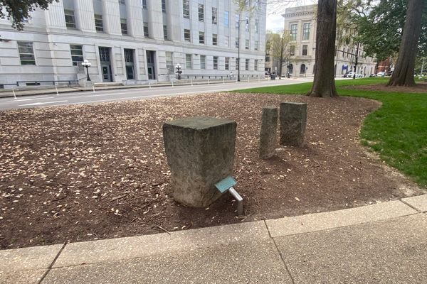
On the southeastern corner of Union Square in Raleigh, North Carolina, home to the North Carolina State Capitol building, is an unusual arrangement of stones. It’s clear these stones were cut and intentionally arranged, but why?
It turns out they were part of a science project in the 1850s to establish accurate latitude and longitude for the location, which then became the basis for other survey measurements in the area.
The researchers took simultaneous readings of the positions of the stars at this spot and compared the readings at locations in Richmond, Virginia. Charleston, and Columbia, South Carolina, a temporary telegraph station was also set up here to communicate with other sites and compare data.
This site is part of the Surveyors Historical Society National Register.